John Smith: Difference between revisions
(Created page with "'''Pioneer Reminiscences''' <br>As related to William S. Lewis Corresponding Secretary of Spokane Historical Society, by Mr. John E. Smith of Reardan, Washington. ---- [Transcribed by Kirk Carlson. Minor typographical and grammatical corrections have been made. Some passages considered offensive to modern readers have been altered and are shown in ''italic font''. You can view the unvarnished version here. Some historical references added. O...") |
No edit summary |
||
| (8 intermediate revisions by the same user not shown) | |||
| Line 2: | Line 2: | ||
<br>As related to William S. Lewis Corresponding Secretary of Spokane Historical Society, by Mr. John E. Smith of Reardan, Washington. | <br>As related to William S. Lewis Corresponding Secretary of Spokane Historical Society, by Mr. John E. Smith of Reardan, Washington. | ||
---- | ---- | ||
[Transcribed by Kirk Carlson. Minor typographical and grammatical corrections have been made. Some passages considered offensive to modern readers have been altered and are shown in ''italic font''. You can view the unvarnished version [[John Smith (unvarnished)| here]]. Some historical references added. Original is held by the Northwest Room of the Spokane | [Transcribed by Kirk Carlson. Minor typographical and grammatical corrections have been made. 'Welleweber' was changed to '[Otto] Wollweber' based on newspaper accounts. Some passages considered offensive to modern readers have been altered and are shown in ''italic font''. You can view the unvarnished version [[John Smith (unvarnished)| here]]. Some historical references added. Original is held by the Northwest Room of the Spokane Public Library (Central Library).] | ||
---- | ---- | ||
[[File:2023-02-27-kirk-0057-john-smith-headstone-1600.jpg|thumb|right|100px]] | |||
Background: John Smith died October 24, 1920 and is buried in the West Greenwood Cemetery near the Coulee Hite Road. | Background: John Smith died October 24, 1920 and is buried in the West Greenwood Cemetery near the Coulee Hite Road. | ||
---- | ---- | ||
I was born at Newark, New Jersey, on June 8th, | [[file:1910-1920-spl-0008a-john-smith-reminisces-01-1600.jpg|thumb|right|200px|page 1]] | ||
[[file:1919-clayton-019a-scharman-j-smith-o-wolweber-q-g-wolweber-t-nunn-williams-p-tramm-q.jpg|thumb|left|400px|John Smith second from left in 1919. From Clayton photo collection.]] | |||
I was born at Newark, New Jersey, on June 8th, 1835. My parents were both Scotch. my mother was Margaret Easton; my father, John Smith. As a small boy I was often on the boats about Newark and Passaic, New Jersey. In 1849, when I was a lad of fourteen years, I sailed from New York for California as Cabin Boy in the "Mary and Adeline," a government transport that brought out some troops to California. If I recall correctly, there were two companies of the 2nd Infantry. We went around the horn. This was my first experience at sea. | |||
In California, I shipped on the steamboat "McKinnon," carrying freight and passengers from San Francisco to Sacramento. Later I went from Sacramento to the north fork of the American River, where I placer mined. From there I went to Coloma, on the South Fork, where Sutter had his saw mill, and in the mill race of which the first gold had been discovered. | In California, I shipped on the steamboat "McKinnon," carrying freight and passengers from San Francisco to Sacramento. Later I went from Sacramento to the north fork of the American River, where I placer mined. From there I went to Coloma, on the South Fork, where Sutter had his saw mill, and in the mill race of which the first gold had been discovered. | ||
| Line 12: | Line 15: | ||
In 1852 I went by boat from Humboldt Bay, California, to a mining town called Trinidad; then from there to Scott's River; from there to Yreka, California; and from there overland to Jacksonville, Jackson County, Oregon. At Jacksonville, I freighted from Crescent City, on the coast near the California line, to Jacksonville. | In 1852 I went by boat from Humboldt Bay, California, to a mining town called Trinidad; then from there to Scott's River; from there to Yreka, California; and from there overland to Jacksonville, Jackson County, Oregon. At Jacksonville, I freighted from Crescent City, on the coast near the California line, to Jacksonville. | ||
[[file:1910-1920-spl-0008a-john-smith-reminisces-02-1600.jpg|thumb|right|200px|page 2]] | |||
In 1854 I joined a company made up at Jacksonville and organized by Captain Jesse Walker the 2nd Oregon Militia, if I remember correctly. The company was used as an escort to go out on the plains and meet settlers coming to Oregon by the southern route. In 1855 or 1956 the Rogue River war broke out and many settlers were killed by the Indians. I joined the Oregon Volunteer Militia and worked in the Quartermaster's Department and had charge of the freight outfit under Captain Jesse Walker. We did everything then with pack animals. I have my discharge papers yet. I had served in the Rogue River Indian War of 1853-1855. | In 1854 I joined a company made up at Jacksonville and organized by Captain Jesse Walker the 2nd Oregon Militia, if I remember correctly. The company was used as an escort to go out on the plains and meet settlers coming to Oregon by the southern route. In 1855 or 1956 the Rogue River war broke out and many settlers were killed by the Indians. I joined the Oregon Volunteer Militia and worked in the Quartermaster's Department and had charge of the freight outfit under Captain Jesse Walker. We did everything then with pack animals. I have my discharge papers yet. I had served in the Rogue River Indian War of 1853-1855. | ||
| Line 20: | Line 24: | ||
I worked under Ben Drew as assistant pack master of one of the pack trains. There were about 100 mules in our train, and probably 200 or more mules in all the pack trains. Each company had a pack train to carry the company baggage, rations and supplies. | I worked under Ben Drew as assistant pack master of one of the pack trains. There were about 100 mules in our train, and probably 200 or more mules in all the pack trains. Each company had a pack train to carry the company baggage, rations and supplies. | ||
[[file:1910-1920-spl-0008a-john-smith-reminisces-03-1600.jpg|thumb|right|200px|page 3]] | |||
In marching, our formation was a couple of companies of dragoons ahead; then the artillery, men and equipped as infantry being afoot, then the pack trains composed of 200 or more animals; and a rear guard of a couple of companies of dragoons. In marching we were strung out over the country for probably a mile. Leaving Fort Walla Walla, we went down Two Canyon where we crossed the Snake River. From the Snake River we struck north to the Palouse River, then across to Cow Creek. From Cow Creek our next camp was at Lagoon Spring; then we moved on to Fish Trap Lake which was our next camp. Here we had a brush with the Indians, the first we had seen since leaving the Snake River. The country thereabouts is rocky and scabby, and some of the Indians got on the high rocks and shot into camp several times; a company of dragoons was sent after them, but as far as I knew no one was hurt on either side. Our camp at what is now called Fish Trap Lake was then called Poison Camp. One of the soldiers gathered a mess of wild parsnips, and ate them, they killed him. He was buried there; hence the name. From this camp we moved on to the Four Lakes Country; we camped at the southwest end of the East Lake, which is now known as Clear Lake. From Poison Camp we saw Indians in bunches of two or there on the hills all day until we reached Clear Lake. | In marching, our formation was a couple of companies of dragoons ahead; then the artillery, men and equipped as infantry being afoot, then the pack trains composed of 200 or more animals; and a rear guard of a couple of companies of dragoons. In marching we were strung out over the country for probably a mile. Leaving Fort Walla Walla, we went down Two Canyon where we crossed the Snake River. From the Snake River we struck north to the Palouse River, then across to Cow Creek. From Cow Creek our next camp was at Lagoon Spring; then we moved on to Fish Trap Lake which was our next camp. Here we had a brush with the Indians, the first we had seen since leaving the Snake River. The country thereabouts is rocky and scabby, and some of the Indians got on the high rocks and shot into camp several times; a company of dragoons was sent after them, but as far as I knew no one was hurt on either side. Our camp at what is now called Fish Trap Lake was then called Poison Camp. One of the soldiers gathered a mess of wild parsnips, and ate them, they killed him. He was buried there; hence the name. From this camp we moved on to the Four Lakes Country; we camped at the southwest end of the East Lake, which is now known as Clear Lake. From Poison Camp we saw Indians in bunches of two or there on the hills all day until we reached Clear Lake. | ||
| Line 26: | Line 31: | ||
From Clear Lake we came east across White Bluff plains [now Spokane West Plains] to what was later known as Head's Ranch<ref>Sarah Head got a homestead for the W/2 W/2 section 8, T25N R42E. This is approximately at the intersection of Trail Road and Old Trails Road.</ref>. Coming from Clear Lake we had another brush with the Indians. The Indians set fire to the prairie grass ahead of the soldiers. The fight was about where Head's place is. I saw one dead Indian. It was reported that several were killed. | From Clear Lake we came east across White Bluff plains [now Spokane West Plains] to what was later known as Head's Ranch<ref>Sarah Head got a homestead for the W/2 W/2 section 8, T25N R42E. This is approximately at the intersection of Trail Road and Old Trails Road.</ref>. Coming from Clear Lake we had another brush with the Indians. The Indians set fire to the prairie grass ahead of the soldiers. The fight was about where Head's place is. I saw one dead Indian. It was reported that several were killed. | ||
[[file:1910-1920-spl-0008a-john-smith-reminisces-04-1600.jpg|thumb|right|200px|page 4]] | |||
I was, of course, with the pack trains and was not doing any of the fighting. If I remember right, we struck and crossed Hangman's Creek near Greenwood Cemetery, at its mouth. We preceded on east across the rocky ground between Liberty Park and the Spokane River, and camped on the prairie, at the bend of the River, near the ford, which was located at the head of the River, near the present Spokane & Inland Bridge<ref>This sounds like it is near Plante's Ferry</ref>. | I was, of course, with the pack trains and was not doing any of the fighting. If I remember right, we struck and crossed Hangman's Creek near Greenwood Cemetery, at its mouth. We preceded on east across the rocky ground between Liberty Park and the Spokane River, and camped on the prairie, at the bend of the River, near the ford, which was located at the head of the River, near the present Spokane & Inland Bridge<ref>This sounds like it is near Plante's Ferry</ref>. | ||
| Line 32: | Line 38: | ||
At this time there was a large Indian camp about 16 miles up the River. Col. Wright held more consultations with the Indians. He gave it out that he was going up to Colville, and he hired some Indian guides to take him there. After being in camp a couple of days, he broke camp and sent part of his pack train across the river by the ford; then he started 2 companies of dragoons up the river. He left the rest of his command in the camp for several hours; then he recalled the pack train from the north side of the river and we all set out up the river. We followed the river most of the way, and camped just north of what is now Seaton Station, on the Spokane & Inland Electric Road. About a mile and a half before coming to the camp we passed the large Indian camp on the south bank of the Spokane River. The Indians had deserted it, leaving many of their lodges and considerable of their property. Near here Captain Ord with some 12 men saw some Indians on the opposite side of the River and shot at them and killed some of their horses. I don't think that any of the Indians were hurt. Ord, I believe, afterwards became a general in the Civil War. A short distance above our camp ground there was a ford across the river. | At this time there was a large Indian camp about 16 miles up the River. Col. Wright held more consultations with the Indians. He gave it out that he was going up to Colville, and he hired some Indian guides to take him there. After being in camp a couple of days, he broke camp and sent part of his pack train across the river by the ford; then he started 2 companies of dragoons up the river. He left the rest of his command in the camp for several hours; then he recalled the pack train from the north side of the river and we all set out up the river. We followed the river most of the way, and camped just north of what is now Seaton Station, on the Spokane & Inland Electric Road. About a mile and a half before coming to the camp we passed the large Indian camp on the south bank of the Spokane River. The Indians had deserted it, leaving many of their lodges and considerable of their property. Near here Captain Ord with some 12 men saw some Indians on the opposite side of the River and shot at them and killed some of their horses. I don't think that any of the Indians were hurt. Ord, I believe, afterwards became a general in the Civil War. A short distance above our camp ground there was a ford across the river. | ||
[[file:1910-1920-spl-0008a-john-smith-reminisces-05-1600.jpg|thumb|right|200px|page 5]] | |||
At this camp we hung the Indian we had brought along with us from our last camp. We hung him from one of the poplar trees growing along the river bank near our camp. They used my lasso rope to hang him. Tom Beale, who now lives near Lewiston, Idaho, and who had been in Col. Steptoe's command, acted as hangman. Lieutenant Mullan, of Mullan Road [fame], had joined our party, and he had a light wagon―the only wagon in the outfit―in which he carried his surveying tools and instruments. ''[Description omitted.]'' | At this camp we hung the Indian we had brought along with us from our last camp. We hung him from one of the poplar trees growing along the river bank near our camp. They used my lasso rope to hang him. Tom Beale, who now lives near Lewiston, Idaho, and who had been in Col. Steptoe's command, acted as hangman. Lieutenant Mullan, of Mullan Road [fame], had joined our party, and he had a light wagon―the only wagon in the outfit―in which he carried his surveying tools and instruments. ''[Description omitted.]'' | ||
While at this camp the dragoons drove into camp a big lot of Indian's horses which they had captured at Saltese Lake. The Indians from the big camp had tried to drive them off out of the country. The Indians abandoned their camp and tried to run the horses off through the hills by the trails leading south by Saltese Lake, but Col. Wright foiled them; if I remember right there was 804 horses; they were rounded up in a little bend of the river, about a mile below where the rocky point juts out toward the river from the south, a short distance above where we camped. There was a sort of a bar there, over grown with quaking [aspen] and bushes. The horses were crowded together here. ''The horses were shot.'' Many of the civilians smuggled out horses for themselves. [ [https://www.historylink.org/File/5142 Another account.]] | While at this camp the dragoons drove into camp a big lot of Indian's horses which they had captured at Saltese Lake. The Indians from the big camp had tried to drive them off out of the country. The Indians abandoned their camp and tried to run the horses off through the hills by the trails leading south by Saltese Lake, but Col. Wright foiled them; if I remember right there was 804 horses; they were rounded up in a little bend of the river, about a mile below where the rocky point juts out toward the river from the south, a short distance above where we camped. There was a sort of a bar there, over grown with quaking [aspen] and bushes. The horses were crowded together here. ''The horses were shot.'' Many of the civilians smuggled out horses for themselves. [ [https://www.historylink.org/File/5142 Another account.]] | ||
[[file:1910-1920-spl-0008a-john-smith-reminisces-06-1600.jpg|thumb|right|200px|page 6]] | |||
Then we broke camp, to go to the Coeur d'Alene Mission [at [wiki:Old Mission State Park | Cataldo], many of these horses were in out outfit, being led by the men. When we got near the little falls―Post Falls―I noticed a bunch of horses having collected beside the line of march ahead of me. One of the men had given me one of the Indian ponies to lead. I was riding a mule, so I got off the mule and mounted the pony. When I got up to the bunch of horses, I found that the Quartermaster was stopping everyone who was leading an extra horse. The officers thought these horses would take up too much time, require too much attention, so they gathered them all, and killed them there. They let me by riding the pony and leading the mule. Between Post Falls and Coeur d'Alene, near where the town of Coeur d'Alene is, I noticed some small enclosed fields cultivated by the Indians. The first, I believe, I had seen on the expedition. | Then we broke camp, to go to the Coeur d'Alene Mission [at [wiki:Old Mission State Park | Cataldo], many of these horses were in out outfit, being led by the men. When we got near the little falls―Post Falls―I noticed a bunch of horses having collected beside the line of march ahead of me. One of the men had given me one of the Indian ponies to lead. I was riding a mule, so I got off the mule and mounted the pony. When I got up to the bunch of horses, I found that the Quartermaster was stopping everyone who was leading an extra horse. The officers thought these horses would take up too much time, require too much attention, so they gathered them all, and killed them there. They let me by riding the pony and leading the mule. Between Post Falls and Coeur d'Alene, near where the town of Coeur d'Alene is, I noticed some small enclosed fields cultivated by the Indians. The first, I believe, I had seen on the expedition. | ||
| Line 42: | Line 50: | ||
From the mission we went down the Coeur d'Alene River 5 or 6 miles and camped; then crossed the river. It took us a day to cross. Col. Wright had canvas boats with him, we also had some Indian boats to hold us. We camped one night on the other side, then proceeded to the mouth of the St. Joe [River and] camped there two nights, one camp on each side of the river. From the mouth of the St. Joe, I think that our next camp was on Latah or Hangman Creek, though my recollection is not quite clear whether we made this in one march or not. | From the mission we went down the Coeur d'Alene River 5 or 6 miles and camped; then crossed the river. It took us a day to cross. Col. Wright had canvas boats with him, we also had some Indian boats to hold us. We camped one night on the other side, then proceeded to the mouth of the St. Joe [River and] camped there two nights, one camp on each side of the river. From the mouth of the St. Joe, I think that our next camp was on Latah or Hangman Creek, though my recollection is not quite clear whether we made this in one march or not. | ||
Our camp on the creek was at a place where there is quite a prairie on the creek bottom―15 or 20 acres―at which point where there is not much of a canyon, and not much water in the creek―a point near where the old "Kentuck" trail afterward crossed the creek; if I recall, this is about 18 or 20 miles south from the present City of Spokane. Here a council was held by Col. Wright with some of the Indians. While we were here, Qualchan―the Yakima Chief, came riding into camp one morning on a gray horse. <ref> | [[file:1910-1920-spl-0008a-john-smith-reminisces-07-1600.jpg|thumb|right|200px|page 7]] | ||
Our camp on the creek was at a place where there is quite a prairie on the creek bottom―15 or 20 acres―at which point where there is not much of a canyon, and not much water in the creek―a point near where the old "Kentuck" trail afterward crossed the creek; if I recall, this is about 18 or 20 miles south from the present City of Spokane. Here a council was held by Col. Wright with some of the Indians. While we were here, Qualchan―the Yakima Chief, came riding into camp one morning on a gray horse. <ref>Qualchan was wanted for killing six miners on the Yakima River whom the Indians suspected of assaulting and raping one of their women.</ref> His ''wife''<ref>Qualchan's wife was named Whist-alks</ref> and another Indian<ref>Qualchan's brother Lo-Kout.</ref> were with him. He had a paper which he gave to Col. Wright. On this paper was written in English: "Here is your man, catch him." It was the talk among the soldier that either Chief Garry or the Priests at the Coeur d'Alene Mission had written the note and gave it to Qualchan and sent him into Col. Wright's Camp with it. I think it was Chief Garry who gave Qualchan the paper. | |||
There was a big pine tree on the hillside near Col. Wright's tent which was pitched near the mouth of a gulch. Behind Wright's tent, the tree leaned out over the hill. The wouldn't allow civilians about the headquarters, but several of the men and myself, got in back of Col. Wright's tent and saw what was going on. They put a rope around a limb of the tree and pulled Qualchan up. ''[description omitted]'' Tom Beall acted as hangman. It was reported about the camp that he got $20.00 for each hanging. When we moved from this camp, we took along an old Indian Chief, Owyi, Qualchan's father. On our way back at Two Canyon Creek, he was shot while trying to escape. [ [https://www.historylink.org/File/5141 Another account.]] | There was a big pine tree on the hillside near Col. Wright's tent which was pitched near the mouth of a gulch. Behind Wright's tent, the tree leaned out over the hill. The wouldn't allow civilians about the headquarters, but several of the men and myself, got in back of Col. Wright's tent and saw what was going on. They put a rope around a limb of the tree and pulled Qualchan up. ''[description omitted]'' Tom Beall acted as hangman. It was reported about the camp that he got $20.00 for each hanging. When we moved from this camp, we took along an old Indian Chief, Owyi, Qualchan's father. On our way back at Two Canyon Creek, he was shot while trying to escape. [ [https://www.historylink.org/File/5141 Another account.]] | ||
[[file:1910-1920-spl-0008a-john-smith-reminisces-08-1600.jpg|thumb|right|200px|page 8]] | |||
On my return to Fort Walla [Walla] with Col. Wright's command, in the fall of 1858, I hired out to Messers. Greenleaf & Allen, of San Francisco, who ran sutler's stores at the various western army posts, and at Walla Walla. I worked at this until 1861. In 1859, I went out to the Boundary Survey with two companies of infantry soldiers who came from the Dalles; we met Captain McClellan at Okanogan Lake. I stayed there several weeks, until September or October, and wintered in Walla Walla. In my work for the Suttlers Department, I was regularly in and out of Fort Colville while they were building the post. A road was made from Walla Walla, following the old main traveled Indian trails. There was a camp on this road on Cow Creek, 3 or 4 miles below the lower end of Sprague Lake, named after Major Pickney Lougenbell and called the Lougenbell [now spelled Lugenbeal] Springs. | On my return to Fort Walla [Walla] with Col. Wright's command, in the fall of 1858, I hired out to Messers. Greenleaf & Allen, of San Francisco, who ran sutler's stores at the various western army posts, and at Walla Walla. I worked at this until 1861. In 1859, I went out to the Boundary Survey with two companies of infantry soldiers who came from the Dalles; we met Captain McClellan at Okanogan Lake. I stayed there several weeks, until September or October, and wintered in Walla Walla. In my work for the Suttlers Department, I was regularly in and out of Fort Colville while they were building the post. A road was made from Walla Walla, following the old main traveled Indian trails. There was a camp on this road on Cow Creek, 3 or 4 miles below the lower end of Sprague Lake, named after Major Pickney Lougenbell and called the Lougenbell [now spelled Lugenbeal] Springs. | ||
| Line 54: | Line 64: | ||
I don't recall the names of many of the whites and half breeds then settled in the Colville Valley. Most everyone was called by their first name in those days. Bill, John, or by a nickname as Slim. I don't remember may of the surnames. I think there was a half breed or Frenchman living in the valley by the name of Tom Henry Louis, Frenchman. | I don't recall the names of many of the whites and half breeds then settled in the Colville Valley. Most everyone was called by their first name in those days. Bill, John, or by a nickname as Slim. I don't remember may of the surnames. I think there was a half breed or Frenchman living in the valley by the name of Tom Henry Louis, Frenchman. | ||
[[file:1910-1920-spl-0008a-john-smith-reminisces-09-1600.jpg|thumb|right|200px|page 9]] | |||
In 1861 I went over to the Flathead Reservation in Montana and worked for John Owens, the Indian Agent. In the 1850s there were no settlers in the Spokane Country except LaPlant and [Peone]. In fact, I don't remember any other settlers north of the Snake river in 1858, except about Colville. Antoine LaPlant in 1862 and 1863 was on the north side of the Spokane River near what is now Trent, a little ways back from the river.<ref>Spokane county has a sports complex at [https://www.historylink.org/File/9606 Antoine Plante's Ferry].</ref> | In 1861 I went over to the Flathead Reservation in Montana and worked for John Owens, the Indian Agent. In the 1850s there were no settlers in the Spokane Country except LaPlant and [Peone]. In fact, I don't remember any other settlers north of the Snake river in 1858, except about Colville. Antoine LaPlant in 1862 and 1863 was on the north side of the Spokane River near what is now Trent, a little ways back from the river.<ref>Spokane county has a sports complex at [https://www.historylink.org/File/9606 Antoine Plante's Ferry].</ref> | ||
| Line 60: | Line 71: | ||
In 1863, I went back to Walla Walla and started to freight by pack mules from Walla Walla to Florence, Idaho. On the fall of that year, I went to the gold rush on the Caribou, on the head waters of the Fraser River, in British Columbia. In 1864, I returned to Walla Walla and resumed freighting by pack mules. I freighted into Boise, Idaho; into Wild Horse Creek in the Kootenai Country, in B. C. My route was north from Walla Walla, across the Snake River; I crossed the Spokane River at [https://www.historylink.org/File/7334 Cowley's Bridge], crossed the Pend Oreille at [https://spokanehistorical.org/items/show/574 Seneacquoteen Ferry] [at present day Leclede, Idaho west of Sand Point], crossed the Kootenai at Bonners Ferry, and thence on to the Wild Horse. I continued in the freighting business until I married in 1868. | In 1863, I went back to Walla Walla and started to freight by pack mules from Walla Walla to Florence, Idaho. On the fall of that year, I went to the gold rush on the Caribou, on the head waters of the Fraser River, in British Columbia. In 1864, I returned to Walla Walla and resumed freighting by pack mules. I freighted into Boise, Idaho; into Wild Horse Creek in the Kootenai Country, in B. C. My route was north from Walla Walla, across the Snake River; I crossed the Spokane River at [https://www.historylink.org/File/7334 Cowley's Bridge], crossed the Pend Oreille at [https://spokanehistorical.org/items/show/574 Seneacquoteen Ferry] [at present day Leclede, Idaho west of Sand Point], crossed the Kootenai at Bonners Ferry, and thence on to the Wild Horse. I continued in the freighting business until I married in 1868. | ||
[[file:1910-1920-spl-0008a-john-smith-reminisces-10-1600.jpg|thumb|right|200px|page 10]] | |||
At Walla Walla, on February 6, 1868, I married [Amanda] Mandy Warren, a sister of Joe Warren. We had 12 children; Frank [1869], Hugh [1870], Fred [1874], James [1879], Eugene [1886], Genevieve [1872], Nettie [Esther 1874], Felisia [1885], Maude [1881], Laura [1889], Minnie [1883], and Madge [1876]. After my marriage I settled down to farming on the Touchet River for two years. In 1870 or 1871, we moved to Cow Creek at a point about 14 miles from the Snake River, and about 8 miles from the falls on the Palouse. In the winter of 1878 or 1879, I saw these falls entirely frozen. | At Walla Walla, on February 6, 1868, I married [Amanda] Mandy Warren, a sister of Joe Warren. We had 12 children; Frank [1869], Hugh [1870], Fred [1874], James [1879], Eugene [1886], Genevieve [1872], Nettie [Esther 1874], Felisia [1885], Maude [1881], Laura [1889], Minnie [1883], and Madge [1876]. After my marriage I settled down to farming on the Touchet River for two years. In 1870 or 1871, we moved to Cow Creek at a point about 14 miles from the Snake River, and about 8 miles from the falls on the Palouse. In the winter of 1878 or 1879, I saw these falls entirely frozen. | ||
| Line 68: | Line 80: | ||
In 1879 Deep Creek―the site of the present town―was the principal town and trading place in the county. Mr. Eades kept the store. There was also a settlement at [https://www.historylink.org/File/10231 Medical Lake]; there was a Frenchman there, LaPave (Lefevre), whom I had known in California. Pete LaFavre was a nephew. Spokane was then a small place; I do not recall who kept the store, at Spokane in 1879 and 1880. | In 1879 Deep Creek―the site of the present town―was the principal town and trading place in the county. Mr. Eades kept the store. There was also a settlement at [https://www.historylink.org/File/10231 Medical Lake]; there was a Frenchman there, LaPave (Lefevre), whom I had known in California. Pete LaFavre was a nephew. Spokane was then a small place; I do not recall who kept the store, at Spokane in 1879 and 1880. | ||
[[file:1910-1920-spl-0008a-john-smith-reminisces-11-1600.jpg|thumb|right|200px|page 11]] | |||
I met and personally knew old Dr. John McLaughlin at Salem, Oregon in the 1850s. When I was sick down there, he doctored me. I met his son, David McLaughlin, at Walla Walla in 1858 or 1859, when he was raising a company of men to go to the Cariboo gold diggings on Fraser River. This David McLaughlin left a family at Port Hill, Idaho. A grandson, John McLaughlin, was named after the Doctor. I met the two Eells boys [presumedly Edwin and Myron born at the Tshimakain Mission] in Walla Walla in 1859 or 1860. My wife's sister married Henry Spaulding who was born at the Lapwai Mission. I knew old man Prombrun (Crysolite), Chief Factor, (1) (Trader), (1. Wm. Sinclair, 1854-5, Smith first there 1857, see Campbell letters.), for the Hudson Bay Company at Walla Walla and his family. | I met and personally knew old Dr. John McLaughlin at Salem, Oregon in the 1850s. When I was sick down there, he doctored me. I met his son, David McLaughlin, at Walla Walla in 1858 or 1859, when he was raising a company of men to go to the Cariboo gold diggings on Fraser River. This David McLaughlin left a family at Port Hill, Idaho. A grandson, John McLaughlin, was named after the Doctor. I met the two Eells boys [presumedly Edwin and Myron born at the Tshimakain Mission] in Walla Walla in 1859 or 1860. My wife's sister married Henry Spaulding who was born at the Lapwai Mission. I knew old man Prombrun (Crysolite), Chief Factor, (1) (Trader), (1. Wm. Sinclair, 1854-5, Smith first there 1857, see Campbell letters.), for the Hudson Bay Company at Walla Walla and his family. | ||
| Line 74: | Line 87: | ||
The old Mullen road and the Colville road were the only roads in the Spokane Country in early days. The Mullen road branched off from the Colville road near the crossing of Cow Creek, it crossed Hangman's Creek 5 or 6 miles south of where old man Jackson lived. Jackson was a Canadian Frenchmen and he had a grown half breed lass and in 1860 and 1861 they lived at what was called French Plaine. There was a road house in Cow Creek kept by a Frenchman in the 1860's. From Jackson's place the Mullen road came down across Moran [Prairie], into the grand at the Spokane River near Union Park. | The old Mullen road and the Colville road were the only roads in the Spokane Country in early days. The Mullen road branched off from the Colville road near the crossing of Cow Creek, it crossed Hangman's Creek 5 or 6 miles south of where old man Jackson lived. Jackson was a Canadian Frenchmen and he had a grown half breed lass and in 1860 and 1861 they lived at what was called French Plaine. There was a road house in Cow Creek kept by a Frenchman in the 1860's. From Jackson's place the Mullen road came down across Moran [Prairie], into the grand at the Spokane River near Union Park. | ||
[[file:1910-1920-spl-0008a-john-smith-reminisces-12-1600.jpg|thumb|right|200px|page 12]] | |||
I first met Dan Drumheller in 1868 or 1869, he used to be around Touchet Creek when I lived there. I first met ___ Ceence in 1871 or 1872. He was a caution. He used to freight with oxen from White Bluffs. The Indians stood in awe of him. | I first met Dan Drumheller in 1868 or 1869, he used to be around Touchet Creek when I lived there. I first met ___ Ceence in 1871 or 1872. He was a caution. He used to freight with oxen from White Bluffs. The Indians stood in awe of him. | ||
| Line 80: | Line 94: | ||
On October 28th, 1908, I attended the ceremonies at the erection of the Monument for Camp Washington on Four Mound Prairie. In speaking Mr. O. B. Gilstrap asserted that my old friend Francis Wolfe had been on that site with Stevens and was the only living witness. In the presence of Professor McCormack, [Otto] Wollweber, myself and some others, Wolfe emphatically stated that he had not been there with Stevens. Wolfe had been with Mullen east of the Rockies. | On October 28th, 1908, I attended the ceremonies at the erection of the Monument for Camp Washington on Four Mound Prairie. In speaking Mr. O. B. Gilstrap asserted that my old friend Francis Wolfe had been on that site with Stevens and was the only living witness. In the presence of Professor McCormack, [Otto] Wollweber, myself and some others, Wolfe emphatically stated that he had not been there with Stevens. Wolfe had been with Mullen east of the Rockies. | ||
[[file:1910-1920-spl-0008a-john-smith-reminisces-13-1600.jpg|thumb|right|200px|page 13]] | |||
Guy Haines had previously told me that the site of Camp Washington was at the forks of Coulee Creek; the next day after the unveiling of the monument, I went to visit my old friend, Haines. He said that the Gilstraps had been to see him, but had not mentioned to him anything about the site of Camp Washington, or of their intention to erect a monument at the site. He said that all they had ever asked him about was concerning the ruins of old Spokane House, concerning which he could give no information. Guy Haines told me that he told the Gilstraps concerning the movements of the Stevens party, substantially as follows: | Guy Haines had previously told me that the site of Camp Washington was at the forks of Coulee Creek; the next day after the unveiling of the monument, I went to visit my old friend, Haines. He said that the Gilstraps had been to see him, but had not mentioned to him anything about the site of Camp Washington, or of their intention to erect a monument at the site. He said that all they had ever asked him about was concerning the ruins of old Spokane House, concerning which he could give no information. Guy Haines told me that he told the Gilstraps concerning the movements of the Stevens party, substantially as follows: | ||
| Line 85: | Line 100: | ||
Guy Haines died a short time after my visit to him. He told me, years ago that the old camping ground of the Stevens party was on the flat just east of the forks of Coulee Creek. This is about 3-1/2 miles west of where the monument was placed. The old Colville road to Walla Walla crossed Coulee Creek about half a mile east of this point, which was selected as a wagon crossing on account of the better grade in and out of Coulee Canyon at the forks of the Creek.<ref>The six-ton monument was moved in 1928.</ref> | Guy Haines died a short time after my visit to him. He told me, years ago that the old camping ground of the Stevens party was on the flat just east of the forks of Coulee Creek. This is about 3-1/2 miles west of where the monument was placed. The old Colville road to Walla Walla crossed Coulee Creek about half a mile east of this point, which was selected as a wagon crossing on account of the better grade in and out of Coulee Canyon at the forks of the Creek.<ref>The six-ton monument was moved in 1928.</ref> | ||
{{DEFAULTSORT: Smith, John}} | |||
[[category:Pioneer Stories]] | |||
Latest revision as of 13:34, 13 December 2023
Pioneer Reminiscences
As related to William S. Lewis Corresponding Secretary of Spokane Historical Society, by Mr. John E. Smith of Reardan, Washington.
[Transcribed by Kirk Carlson. Minor typographical and grammatical corrections have been made. 'Welleweber' was changed to '[Otto] Wollweber' based on newspaper accounts. Some passages considered offensive to modern readers have been altered and are shown in italic font. You can view the unvarnished version here. Some historical references added. Original is held by the Northwest Room of the Spokane Public Library (Central Library).]
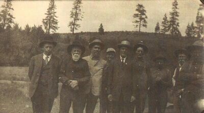
Background: John Smith died October 24, 1920 and is buried in the West Greenwood Cemetery near the Coulee Hite Road.
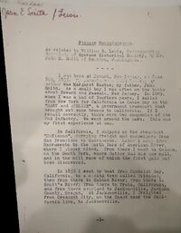
I was born at Newark, New Jersey, on June 8th, 1835. My parents were both Scotch. my mother was Margaret Easton; my father, John Smith. As a small boy I was often on the boats about Newark and Passaic, New Jersey. In 1849, when I was a lad of fourteen years, I sailed from New York for California as Cabin Boy in the "Mary and Adeline," a government transport that brought out some troops to California. If I recall correctly, there were two companies of the 2nd Infantry. We went around the horn. This was my first experience at sea.
In California, I shipped on the steamboat "McKinnon," carrying freight and passengers from San Francisco to Sacramento. Later I went from Sacramento to the north fork of the American River, where I placer mined. From there I went to Coloma, on the South Fork, where Sutter had his saw mill, and in the mill race of which the first gold had been discovered.
In 1852 I went by boat from Humboldt Bay, California, to a mining town called Trinidad; then from there to Scott's River; from there to Yreka, California; and from there overland to Jacksonville, Jackson County, Oregon. At Jacksonville, I freighted from Crescent City, on the coast near the California line, to Jacksonville.
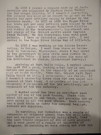
In 1854 I joined a company made up at Jacksonville and organized by Captain Jesse Walker the 2nd Oregon Militia, if I remember correctly. The company was used as an escort to go out on the plains and meet settlers coming to Oregon by the southern route. In 1855 or 1956 the Rogue River war broke out and many settlers were killed by the Indians. I joined the Oregon Volunteer Militia and worked in the Quartermaster's Department and had charge of the freight outfit under Captain Jesse Walker. We did everything then with pack animals. I have my discharge papers yet. I had served in the Rogue River Indian War of 1853-1855.
In 1857 I was working on the [Siletz] Reservation in Oregon. I went from there on horseback to Vancouver, Washington, where I was hired by the government to help drive some cattle to Fort Walla Walla. I have forgotten the name of the Lieutenant in charge. (Lieutenant Harvey)
Arriving in Fort Walla Walla, I worked around the post for a year, looking after cattle and horses and packing, in the capacity of an assistant pack or wagon master. When Col. Wright left Fort Walla Walla in 1858, I accompanied his force. If I remember correctly there were 404 men under his command at that time; 4 companies of the 1st dragoons; 4 companies of the 3rd artillery; and 4 companies of the 9th infantry.
I worked under Ben Drew as assistant pack master of one of the pack trains. There were about 100 mules in our train, and probably 200 or more mules in all the pack trains. Each company had a pack train to carry the company baggage, rations and supplies.
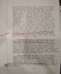
In marching, our formation was a couple of companies of dragoons ahead; then the artillery, men and equipped as infantry being afoot, then the pack trains composed of 200 or more animals; and a rear guard of a couple of companies of dragoons. In marching we were strung out over the country for probably a mile. Leaving Fort Walla Walla, we went down Two Canyon where we crossed the Snake River. From the Snake River we struck north to the Palouse River, then across to Cow Creek. From Cow Creek our next camp was at Lagoon Spring; then we moved on to Fish Trap Lake which was our next camp. Here we had a brush with the Indians, the first we had seen since leaving the Snake River. The country thereabouts is rocky and scabby, and some of the Indians got on the high rocks and shot into camp several times; a company of dragoons was sent after them, but as far as I knew no one was hurt on either side. Our camp at what is now called Fish Trap Lake was then called Poison Camp. One of the soldiers gathered a mess of wild parsnips, and ate them, they killed him. He was buried there; hence the name. From this camp we moved on to the Four Lakes Country; we camped at the southwest end of the East Lake, which is now known as Clear Lake. From Poison Camp we saw Indians in bunches of two or there on the hills all day until we reached Clear Lake.
At Clear Lake there is quite a hill on the east which sloped towards our camp. We camped there 4 or 5 days, nearly a week. While there the Indians would collect on this hill during the day in bunches of 50 or 60; occasionally some would make it a point of riding down towards our camp. At last Col. Wright started 4 companies of dragoons out after them. They lit out. It was reported that the dragoons killed about 20 Indians. This was the Battle of Four Lakes.
From Clear Lake we came east across White Bluff plains [now Spokane West Plains] to what was later known as Head's Ranch[1]. Coming from Clear Lake we had another brush with the Indians. The Indians set fire to the prairie grass ahead of the soldiers. The fight was about where Head's place is. I saw one dead Indian. It was reported that several were killed.
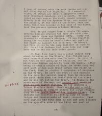
I was, of course, with the pack trains and was not doing any of the fighting. If I remember right, we struck and crossed Hangman's Creek near Greenwood Cemetery, at its mouth. We preceded on east across the rocky ground between Liberty Park and the Spokane River, and camped on the prairie, at the bend of the River, near the ford, which was located at the head of the River, near the present Spokane & Inland Bridge[2].
Col. Wright camped here a couple (2) days. Several Indians crossed the ford and came into camp; among these was Spokane Garry. Garry was dressed in whiteman's clothes. It was reported among the men that he hadn't taken any part in the fighting against the soldiers. He always had free access to the camp whenever he came to it. One of the Indians that came into our camp here was seized and held under guard.
At this time there was a large Indian camp about 16 miles up the River. Col. Wright held more consultations with the Indians. He gave it out that he was going up to Colville, and he hired some Indian guides to take him there. After being in camp a couple of days, he broke camp and sent part of his pack train across the river by the ford; then he started 2 companies of dragoons up the river. He left the rest of his command in the camp for several hours; then he recalled the pack train from the north side of the river and we all set out up the river. We followed the river most of the way, and camped just north of what is now Seaton Station, on the Spokane & Inland Electric Road. About a mile and a half before coming to the camp we passed the large Indian camp on the south bank of the Spokane River. The Indians had deserted it, leaving many of their lodges and considerable of their property. Near here Captain Ord with some 12 men saw some Indians on the opposite side of the River and shot at them and killed some of their horses. I don't think that any of the Indians were hurt. Ord, I believe, afterwards became a general in the Civil War. A short distance above our camp ground there was a ford across the river.
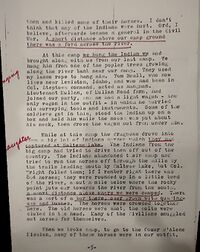
At this camp we hung the Indian we had brought along with us from our last camp. We hung him from one of the poplar trees growing along the river bank near our camp. They used my lasso rope to hang him. Tom Beale, who now lives near Lewiston, Idaho, and who had been in Col. Steptoe's command, acted as hangman. Lieutenant Mullan, of Mullan Road [fame], had joined our party, and he had a light wagon―the only wagon in the outfit―in which he carried his surveying tools and instruments. [Description omitted.]
While at this camp the dragoons drove into camp a big lot of Indian's horses which they had captured at Saltese Lake. The Indians from the big camp had tried to drive them off out of the country. The Indians abandoned their camp and tried to run the horses off through the hills by the trails leading south by Saltese Lake, but Col. Wright foiled them; if I remember right there was 804 horses; they were rounded up in a little bend of the river, about a mile below where the rocky point juts out toward the river from the south, a short distance above where we camped. There was a sort of a bar there, over grown with quaking [aspen] and bushes. The horses were crowded together here. The horses were shot. Many of the civilians smuggled out horses for themselves. [ Another account.]
Then we broke camp, to go to the Coeur d'Alene Mission [at [wiki:Old Mission State Park | Cataldo], many of these horses were in out outfit, being led by the men. When we got near the little falls―Post Falls―I noticed a bunch of horses having collected beside the line of march ahead of me. One of the men had given me one of the Indian ponies to lead. I was riding a mule, so I got off the mule and mounted the pony. When I got up to the bunch of horses, I found that the Quartermaster was stopping everyone who was leading an extra horse. The officers thought these horses would take up too much time, require too much attention, so they gathered them all, and killed them there. They let me by riding the pony and leading the mule. Between Post Falls and Coeur d'Alene, near where the town of Coeur d'Alene is, I noticed some small enclosed fields cultivated by the Indians. The first, I believe, I had seen on the expedition.
Our next camp was at the north end of Coeur d'Alene Lake, about where the present town is. From there we made a short camp on Wolf Lodge. Our next camp was the mission. We stayed there 2 or 3 days. There were only a few of the Indians about.
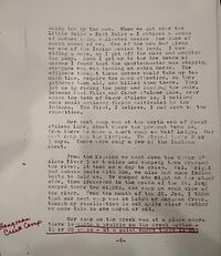
From the mission we went down the Coeur d'Alene River 5 or 6 miles and camped; then crossed the river. It took us a day to cross. Col. Wright had canvas boats with him, we also had some Indian boats to hold us. We camped one night on the other side, then proceeded to the mouth of the St. Joe [River and] camped there two nights, one camp on each side of the river. From the mouth of the St. Joe, I think that our next camp was on Latah or Hangman Creek, though my recollection is not quite clear whether we made this in one march or not.
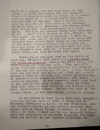
Our camp on the creek was at a place where there is quite a prairie on the creek bottom―15 or 20 acres―at which point where there is not much of a canyon, and not much water in the creek―a point near where the old "Kentuck" trail afterward crossed the creek; if I recall, this is about 18 or 20 miles south from the present City of Spokane. Here a council was held by Col. Wright with some of the Indians. While we were here, Qualchan―the Yakima Chief, came riding into camp one morning on a gray horse. [3] His wife[4] and another Indian[5] were with him. He had a paper which he gave to Col. Wright. On this paper was written in English: "Here is your man, catch him." It was the talk among the soldier that either Chief Garry or the Priests at the Coeur d'Alene Mission had written the note and gave it to Qualchan and sent him into Col. Wright's Camp with it. I think it was Chief Garry who gave Qualchan the paper.
There was a big pine tree on the hillside near Col. Wright's tent which was pitched near the mouth of a gulch. Behind Wright's tent, the tree leaned out over the hill. The wouldn't allow civilians about the headquarters, but several of the men and myself, got in back of Col. Wright's tent and saw what was going on. They put a rope around a limb of the tree and pulled Qualchan up. [description omitted] Tom Beall acted as hangman. It was reported about the camp that he got $20.00 for each hanging. When we moved from this camp, we took along an old Indian Chief, Owyi, Qualchan's father. On our way back at Two Canyon Creek, he was shot while trying to escape. [ Another account.]
On my return to Fort Walla [Walla] with Col. Wright's command, in the fall of 1858, I hired out to Messers. Greenleaf & Allen, of San Francisco, who ran sutler's stores at the various western army posts, and at Walla Walla. I worked at this until 1861. In 1859, I went out to the Boundary Survey with two companies of infantry soldiers who came from the Dalles; we met Captain McClellan at Okanogan Lake. I stayed there several weeks, until September or October, and wintered in Walla Walla. In my work for the Suttlers Department, I was regularly in and out of Fort Colville while they were building the post. A road was made from Walla Walla, following the old main traveled Indian trails. There was a camp on this road on Cow Creek, 3 or 4 miles below the lower end of Sprague Lake, named after Major Pickney Lougenbell and called the Lougenbell [now spelled Lugenbeal] Springs.
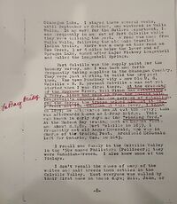
Fort Colville was the supply point for the boundary survey, and I was back and forth frequently taking supplies to the Okanogan Country. They were just starting to build the army post then. The old Pinckney City―now Old U. S. Colville―northeast [of] present Colville―was not yet started when I was first there. At the crossing of the Spokane River, Bill Nixon had established a ferry. Nixon had come up from the Dalles with Lougenbells' command for the purpose of establishing the ferry; the troops helped him put it in. I first met Jim Monaghan at this ferry, I think in 1859; he afterwards bought out the ferry; [which] was afterward known as LaPray Bridge. This was known in early days as the "winding ford." At the Hudson Bay trading post on the Marcus Flats and about H. B. [Hudson Bay] Co. Fort Colville in 1859, I frequently met old Angus McDonald, who was in charge of the trading Post. Archibald McDonald left for Ontario, Can. in 1843.
I recall one family in the Colville Valley in the 1850s named Philisters (Pelliseer); they were Canadian-French. I also knew some of the Finlays.
I don't recall the names of many of the whites and half breeds then settled in the Colville Valley. Most everyone was called by their first name in those days. Bill, John, or by a nickname as Slim. I don't remember may of the surnames. I think there was a half breed or Frenchman living in the valley by the name of Tom Henry Louis, Frenchman.
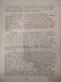
In 1861 I went over to the Flathead Reservation in Montana and worked for John Owens, the Indian Agent. In the 1850s there were no settlers in the Spokane Country except LaPlant and [Peone]. In fact, I don't remember any other settlers north of the Snake river in 1858, except about Colville. Antoine LaPlant in 1862 and 1863 was on the north side of the Spokane River near what is now Trent, a little ways back from the river.[6]
In 1861, I was a Peone's place―stopped there one or two nights, when on my way back and forth from the Flathead Indian Agency. The headquarters for the Indian department of the territory of Washington were then at Salem, Ore. I remember once John Owens, the Flathead Agent, sent a lot of buffalo tongues by me to the Agent in Salem. A dog got in the tent and ate them all up, on my way to Oregon. I think that a man named Nesbit was the Indian Agent at Salem in those days.
In 1863, I went back to Walla Walla and started to freight by pack mules from Walla Walla to Florence, Idaho. On the fall of that year, I went to the gold rush on the Caribou, on the head waters of the Fraser River, in British Columbia. In 1864, I returned to Walla Walla and resumed freighting by pack mules. I freighted into Boise, Idaho; into Wild Horse Creek in the Kootenai Country, in B. C. My route was north from Walla Walla, across the Snake River; I crossed the Spokane River at Cowley's Bridge, crossed the Pend Oreille at Seneacquoteen Ferry [at present day Leclede, Idaho west of Sand Point], crossed the Kootenai at Bonners Ferry, and thence on to the Wild Horse. I continued in the freighting business until I married in 1868.
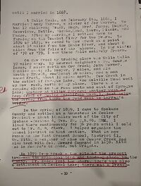
At Walla Walla, on February 6, 1868, I married [Amanda] Mandy Warren, a sister of Joe Warren. We had 12 children; Frank [1869], Hugh [1870], Fred [1874], James [1879], Eugene [1886], Genevieve [1872], Nettie [Esther 1874], Felisia [1885], Maude [1881], Laura [1889], Minnie [1883], and Madge [1876]. After my marriage I settled down to farming on the Touchet River for two years. In 1870 or 1871, we moved to Cow Creek at a point about 14 miles from the Snake River, and about 8 miles from the falls on the Palouse. In the winter of 1878 or 1879, I saw these falls entirely frozen.
On Cow Creek my trading place was Walla Walla 72 miles away. My nearest neighbors were George Lucus, 2 miles north on Cow Creek; John Turner, 8 miles east; Al Hooper, 7 miles and his brother Ernest, southeast 10 miles; and a man named Krost, about 12 miles north. Cow Creek is the outlet of Sprague Lake. The Colville Road went up Cow Creek north of my place. There was a camping place on the road south and west of Sprague Lake; another at Willow Springs; another west of Deep Creek on Coulee Creek (Camp Washington), just below the forks; from there the road went to LaPray's bridge.
In the spring of 1879, I came to Spokane County and settled on a homestead in Coulee Precinct―about 18 miles west of the City of Spokane[southeast quarter] Section 4 Township 26 North, Range 40 East Willamette Meridian. I lived there continuously for 36 years until I sold out to Mr. S. S. Clark. I helped organize the school district in that section, what is now know as the East Crescent School District 81. William Keith, a neighbor of mine on Coulee Creek had also been with Col. Howard's command in 1858. Keith was in Howard's Command, not Wright's.
In 1879 Deep Creek―the site of the present town―was the principal town and trading place in the county. Mr. Eades kept the store. There was also a settlement at Medical Lake; there was a Frenchman there, LaPave (Lefevre), whom I had known in California. Pete LaFavre was a nephew. Spokane was then a small place; I do not recall who kept the store, at Spokane in 1879 and 1880.
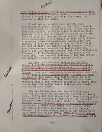
I met and personally knew old Dr. John McLaughlin at Salem, Oregon in the 1850s. When I was sick down there, he doctored me. I met his son, David McLaughlin, at Walla Walla in 1858 or 1859, when he was raising a company of men to go to the Cariboo gold diggings on Fraser River. This David McLaughlin left a family at Port Hill, Idaho. A grandson, John McLaughlin, was named after the Doctor. I met the two Eells boys [presumedly Edwin and Myron born at the Tshimakain Mission] in Walla Walla in 1859 or 1860. My wife's sister married Henry Spaulding who was born at the Lapwai Mission. I knew old man Prombrun (Crysolite), Chief Factor, (1) (Trader), (1. Wm. Sinclair, 1854-5, Smith first there 1857, see Campbell letters.), for the Hudson Bay Company at Walla Walla and his family.
In 1863 and 1864 when freighting to Wild Horse, I used to go over the old "Kentuck" Trail; a cut-off from the Mullen Road near ___ Creek, North of Spangle to what is now known as Spokane Bridge [near the Spokane River Idaho crossing]. This went down over Moran Prairie, and down on the west side of Saltese Lake. I used to camp at the head of the lake. Old [Chief] Saltese used to live there then; I knew him. The trail got its name "Kentuck Trail" and "Kentuck cut off," I think form the road house or eating house built on the trail, east of Hangman Creek.
The old Mullen road and the Colville road were the only roads in the Spokane Country in early days. The Mullen road branched off from the Colville road near the crossing of Cow Creek, it crossed Hangman's Creek 5 or 6 miles south of where old man Jackson lived. Jackson was a Canadian Frenchmen and he had a grown half breed lass and in 1860 and 1861 they lived at what was called French Plaine. There was a road house in Cow Creek kept by a Frenchman in the 1860's. From Jackson's place the Mullen road came down across Moran [Prairie], into the grand at the Spokane River near Union Park.
I first met Dan Drumheller in 1868 or 1869, he used to be around Touchet Creek when I lived there. I first met ___ Ceence in 1871 or 1872. He was a caution. He used to freight with oxen from White Bluffs. The Indians stood in awe of him.
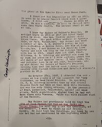
I knew Guy Haines of Walker's Prairie. He settled there in 1853 or 1854 and lived there until he died. His son, Charlie Haines still lives there. His post office address is Springdale or Ford, Washington. Guy Haines had been a member of Gov. I. N. Steven's party; he was with McClellan at Kettle Falls, and was at Camp Washington. I met Haines on the Boundary Line Survey and made the trip to the Caribon Country with him in 1863. About June 1st 1908, Prof. Gilstrap, O. B. Gilstrap and another man came to my farm and asked me if I knew anything about the old ruins of old Spokane House. I told them, no, and referred them to my neighbor, [Otto] Wollweber, and my old friend Guy Haines of Walker's Prairie, telling them that the latter came through the country with Captain McClellan and Governor Steven's parties in 1853.
On October 28th, 1908, I attended the ceremonies at the erection of the Monument for Camp Washington on Four Mound Prairie. In speaking Mr. O. B. Gilstrap asserted that my old friend Francis Wolfe had been on that site with Stevens and was the only living witness. In the presence of Professor McCormack, [Otto] Wollweber, myself and some others, Wolfe emphatically stated that he had not been there with Stevens. Wolfe had been with Mullen east of the Rockies.
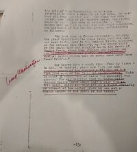
Guy Haines had previously told me that the site of Camp Washington was at the forks of Coulee Creek; the next day after the unveiling of the monument, I went to visit my old friend, Haines. He said that the Gilstraps had been to see him, but had not mentioned to him anything about the site of Camp Washington, or of their intention to erect a monument at the site. He said that all they had ever asked him about was concerning the ruins of old Spokane House, concerning which he could give no information. Guy Haines told me that he told the Gilstraps concerning the movements of the Stevens party, substantially as follows:
"We left camp at Chamokane Mission, keeping the great Colville-Walla Walla trail over the hill and sand flats, down to the Spokane River, crossing at the winding ford (Island), up the other bluff on the south side and straight on to the forks of Coulee Creek, where they stopped and waited for the westbound Donaldson part, and celebrated. Further Haines stated we never came near Four Mound Prairie."
Guy Haines died a short time after my visit to him. He told me, years ago that the old camping ground of the Stevens party was on the flat just east of the forks of Coulee Creek. This is about 3-1/2 miles west of where the monument was placed. The old Colville road to Walla Walla crossed Coulee Creek about half a mile east of this point, which was selected as a wagon crossing on account of the better grade in and out of Coulee Canyon at the forks of the Creek.[7]
- ↑ Sarah Head got a homestead for the W/2 W/2 section 8, T25N R42E. This is approximately at the intersection of Trail Road and Old Trails Road.
- ↑ This sounds like it is near Plante's Ferry
- ↑ Qualchan was wanted for killing six miners on the Yakima River whom the Indians suspected of assaulting and raping one of their women.
- ↑ Qualchan's wife was named Whist-alks
- ↑ Qualchan's brother Lo-Kout.
- ↑ Spokane county has a sports complex at Antoine Plante's Ferry.
- ↑ The six-ton monument was moved in 1928.

