File:1951-07-15-sr-p59b-colville-military-road-map.jpg
Jump to navigation
Jump to search

Size of this preview: 227 × 598 pixels. Other resolution: 1,320 × 3,476 pixels.
Original file (1,320 × 3,476 pixels, file size: 631 KB, MIME type: image/jpeg)
Summary
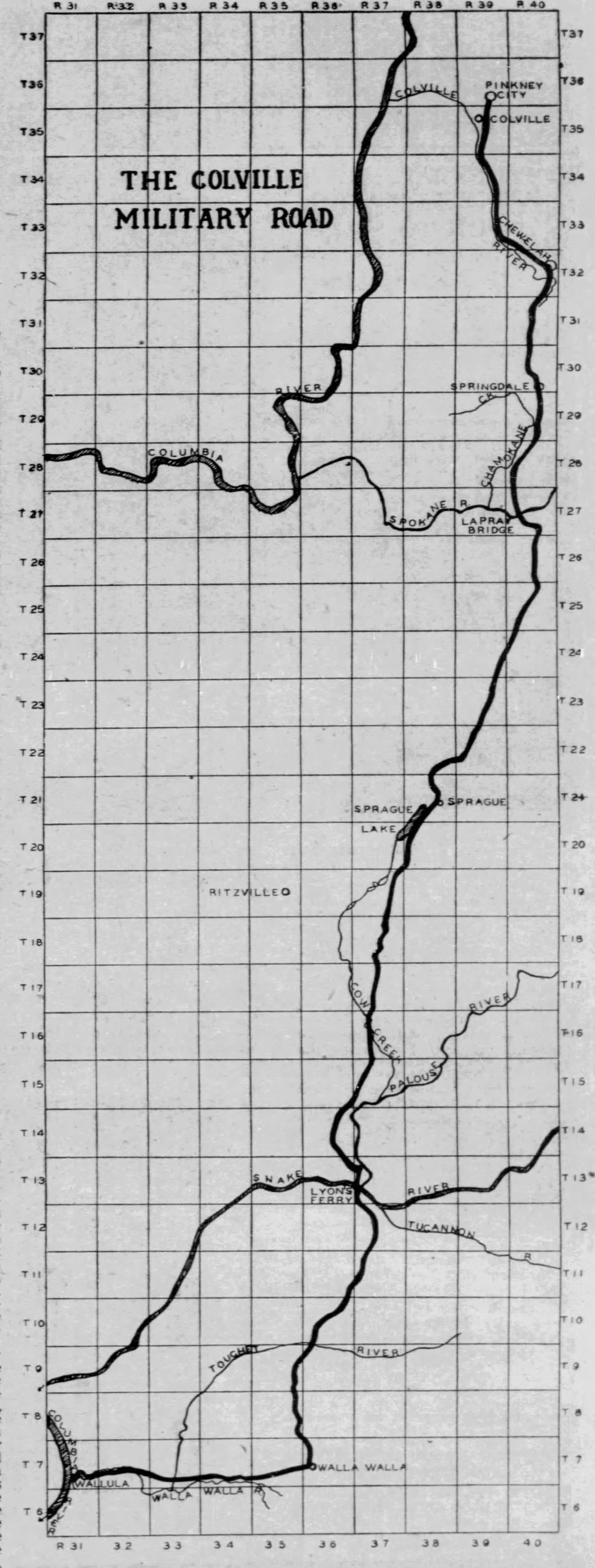
Map of the Colville Military Road from the Spokesman Review July 15, 1951.
File history
Click on a date/time to view the file as it appeared at that time.
| Date/Time | Thumbnail | Dimensions | User | Comment | |
|---|---|---|---|---|---|
| current | 11:27, 22 November 2022 | 1,320 × 3,476 (631 KB) | Kirk (talk | contribs) | Map of the Colville Military Road from the Spokesman Review July 15, 1951. |
You cannot overwrite this file.
File usage
The following page uses this file: