Category:Maps
Jump to navigation
Jump to search
These are maps of the area showing its history and diversity.
Subcategories
This category has only the following subcategory.
M
- Maps of the Long Lake Railroad (1 P, 22 F)
Pages in category "Maps"
The following 3 pages are in this category, out of 3 total.
Media in category "Maps"
The following 13 files are in this category, out of 13 total.
- 1888-rml-0252-hanel-partial-reardan-plat-1600.jpg 651 × 900; 216 KB
- 1889-06-11-rml-0246-deed-of-streets-fellows-to-reardan-1600.jpg 674 × 900; 225 KB
- 1906-rml-0247-james-edwards-idaho-surveyor-license-1600.jpg 1,170 × 900; 364 KB
- 1941-08-31-rml-0255-james-edwards-obit-1600.jpg 1,600 × 835; 232 KB
- 1951-07-15-sr-p59b-colville-military-road-map.jpg 1,320 × 3,476; 631 KB
- 2022-01-23-arcgis-0000-screencapture-t25n-r39ewm.jpg 1,708 × 894; 806 KB
- 567th Strategic Missile Squadron - SM-65E Atlas Missile Sites.png 800 × 480; 238 KB
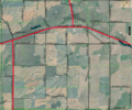
- Aerial-t25n-r39ewn.png 767 × 638; 880 KB
- Part-t25n-r39ewm.png 746 × 569; 579 KB
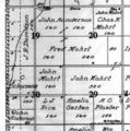
- Sections-19-20-29-30-t25n-r39ewm.png 271 × 273; 132 KB
- Systemic-numbering-in-the-public-land-survey-system.gif 412 × 287; 15 KB
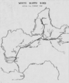
- White Bluffs Road map.png 1,532 × 1,828; 762 KB


